
What Time Will It Start Snowing Today In Minnesota?
With every weather-related event people want to know when it will start to snow or rain, or in general when it will affect them. The National Weather Service in the Twin Cities put out a graphic around 7:30 this morning on when areas of Minnesota should start to see rain and or snow begin to fall.
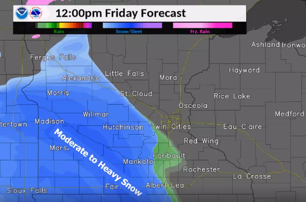
The graphic shows the snow sweeping into the state from the Southwest and moving to the Northeast. Around noon the system should cross I-35 and bring some rain/mixed precipitation to the Faribault and Owatonna area after that expect to see heavy snow moving into the area after 1 PM and lasting through 4 PM.
Areas to our east like Rochester and Preston will see rain/mixed precipitation start falling around 1 PM with heavy snowfall following that around 2 PM.
A Winter Storm Warning has been declared for portions of Southern Minnesota and states that;
"MOST OF THE SNOW WILL FALL LATE FRIDAY MORNING INTO FRIDAY EVENING. TOTALS OF 5 TO 9 INCHES OF SNOW ARE EXPECTED ACROSS MUCH OF CENTRAL AND SOUTHERN MINNESOTA AND WESTERN WISCONSIN. SNOW WILL TAPER OFF LATER FRIDAY NIGHT, BUT VERY STRONG NORTHWEST WINDS GUSTING TO 40 AND 50 MPH WILL DEVELOP ON SATURDAY, ESPECIALLY IN WESTERN MINNESOTA. BLOWING SNOW WILL BE WIDESPREAD WITH NEAR ZERO VISIBILITY IN OPEN COUNTRY, WITH THE WORST CONDITIONS FROM WEST CENTRAL INTO SOUTH CENTRAL MINNESOTA. IN ADDITION, FALLING TEMPERATURES WILL LEAD TO ICY ROADS AND VERY COLD TEMPERATURES, ESPECIALLY ON SATURDAY. THIS STORM WILL IMPACT TRAVEL. EXPECT SNOW-COVERED ROADS FOLLOWED BY STRONG WINDS, BLOWING SNOW AND FALLING TEMPERATURES."
Stay up to date on the weather and closings and delays on our free app.

More From Quick Country 96.5


